


I grew up less than half a mile from Interstate 75 in Hahira, Georgia. The COVID-19 pandemic started during my junior year of high school. While the world faced one of the most extraordinary moments in a generation, I woke up every day, did my “online school” packets in less than half an hour, and then spent a large part of the day biking. With nothing but time to kill, I spent hours riding along service roads next to I-75, watching the semi-trucks, and thinking about when I’d be able to see my friends again. Across the United States, communities like mine rely on interstates as hubs of commerce, commuting, and, in my case, connection to the outside world in a period of isolation. What many people don’t know, though, is that whenever they are near interstates like these, nuclear weapons are often driving right past them.
On Oct. 1, 2024, the National Nuclear Security Administration (NNSA) announced it produced, for the first time in over a decade, a new plutonium pit — the explosive core of nuclear weapons — at Los Alamos National Lab. But what does this have to do with a high schooler biking along the interstate during the pandemic? As part of a new plan to restart large-scale production of plutonium pits for the first time since the Cold War, the NNSA plans to ship nuclear cores across the length of US interstates without clearly informing residents. This raises the risk of accident — or malicious attack — for American communities along the interstates, like mine.
Not only is the NNSA restarting pit production; it will do so at multiple production sites. Plutonium pits will be produced for the first time at the Savannah River Site (SRS) near Aiken, South Carolina. SRS is over 1,200 miles from both Los Alamos, where pits are also being produced, and the Pantex plant in Texas, where the pits will be assembled into new nuclear weapons for the first time since the end of the Cold War. This plan, which seems to be driven more by a desire for jobs at SRS than suitability for the task, will expand the production and transportation zone for nuclear weapons dramatically.
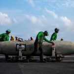
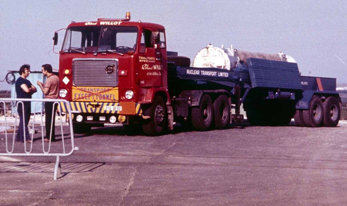
The United States government ships its nuclear materials, mostly on US interstates, in unmarked semi trucks. Today, the government uses services like the Web-Based Transportation Routing Analysis Geographic Information System (WebTRAGIS) — think Google Maps but for hazardous waste shipments — to route the trucks across the country. For most of its shipments, the NNSA has a specific mandate: use the most direct route possible along (mostly) federal highways. This means, with few exceptions, the route used between two sites will stay the same across all types of shipments. The transport trucks are well-designed to handle travel and, in almost all cases, very safe. Still, as the scope of transportation will be aggressively expanded, especially through crowded metro areas like Atlanta, Memphis, and Oklahoma City, the risk of accidents or danger from malicious actors increases.
The NNSA has historically been cagey about transparency surrounding nuclear shipments, leaving the work to mostly outside groups. A famous map from 1988 by the Radioactive Waste Campaign showed most routes used by the weapons complex when nuclear material was mostly shipped by train. A curious map by Jeff Berlin, which seeks to show all trucking routes for nuclear materials, was featured in a 2012 Mother Jones article. Because it lacks sourcing, it is hard to tell where the information is from and how accurate or reliable it is, although clearly some of it — the Air Force missile and Navy submarine bases, for example — is correct. It shows a web of routes criss-crossing the country from upstate Washington to central Florida. These maps are still some of the best preserved windows into how the nuclear weapons complex has evolved.
“The United States government ships its nuclear materials, mostly on US interstates, in unmarked semi trucks.”
The NNSA has released some information about the transportation of plutonium pits, pit-related materials, and plutonium waste as they’ve expanded the geographic scope of production. In the draft 2025 site-wide economic impact statement of Los Alamos National Lab, the NNSA published an extensive list of planned pit production-related shipments between various sites, the distances of those routes, and the guidelines by which routes are generally picked. Still, the NNSA failed to directly publish which routes would be used.
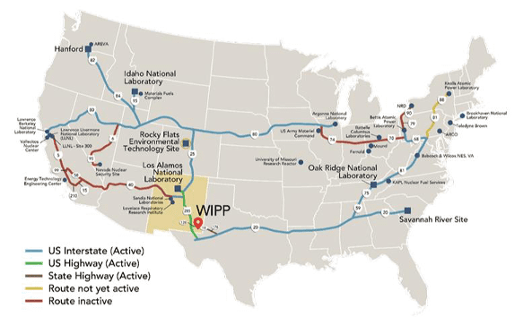
On other modern programs, the NNSA has been more forthcoming. The agency produced a high-quality route map to accompany the release of its Surplus Plutonium Disposition Environmental Impact Statement showing exactly where and how material would be moved. Although that program is now in limbo under new direction from the Trump administration, the map gives the clearest look at where plutonium is or could be shipped. In a separate effort, for plutonium waste being shipped to the Waste Isolation Pilot Plant (WIPP), the DOE has shared a few maps of its routes that are easily available on its websites.
The question remains: Why hasn’t the NNSA published a map of routes that will support plutonium pit production? It has been forthcoming about other programs and has published the length of the routes for the plutonium pit program, albeit on page 481 of an appendix to a draft environmental impact statement. The lack of clarity on what routes pits will be moved on — especially as the inclusion of SRS is dramatically expanding the involved regions — is troubling. After all, weapons-relevant quantities (multi-kg) of plutonium will now be on new roads across the southern United States, along with radioactive waste generated during production.
In a program already mired in controversy from cost overruns and environmental concerns, it is not surprising the NNSA is not eager to share the potential impacts from transportation. The NNSA could argue that the sensitivity of the shipments would preclude publishing information about the routes. Still, the NNSA has published route distances, maps of waste movement, and the guidelines for where pit production material is moved. In other words, any determined person could already figure out where the material is moving.
There is still time for the NNSA to publish the planned routes before beginning pit production at Savannah River Site in the 2030s. The NNSA is currently producing a Programmatic Environmental Impact Statement for Plutonium Pit Production, and these routes should be included in that document. Transparency in routing would be a first step toward a more informed public which understands the everyday impact of the nuclear weapons complex. Especially for communities like mine, which are centered around America’s interstates, understanding the real risks posed by the nuclear complex would change the way communities think of nuclear issues. Nukes do not merely exist in a post-apocalyptic world — they are driving past kids biking on interstate services roads to get out of doing school work. Barring change, they will soon be driving past many more.